


GNSS Station OL01 - Geodetic survey
IThe OL01 station dataset, recorded in RINEX format files, is available in daily sessions and with 30-second sampling (2880 daily observations). There are 743 RINEX files registered through 31/05/2019. Data processing has produced 683 solutions or 91.9% of the initial data. This indicates the availability of a formally correct dataset suitable for processing with the GAMIT/GLOBK package.
The GNSS OL01 station has been framed within a network of permanent stations called the Lodi GNSS network (Figure 1) using the following 4 stations belonging to the SPIN Network:
• CREM (Cremona), baseline equal to 45.1 km;
• CREM (Cremona), baseline equal to 45.1 km;
• MILA (Milan), baseline equal to 27.9 km;
• PAVI (Pavia), baseline equal to 27.6 km.
These stations are in turn framed in the ETRF2000 (2008.0) system with the coordinates provided by SPIN GNSS according to the National Dynamic Network managed by the Military Geographic Institute. The result of framing the OL01 station is shown in Table 1.
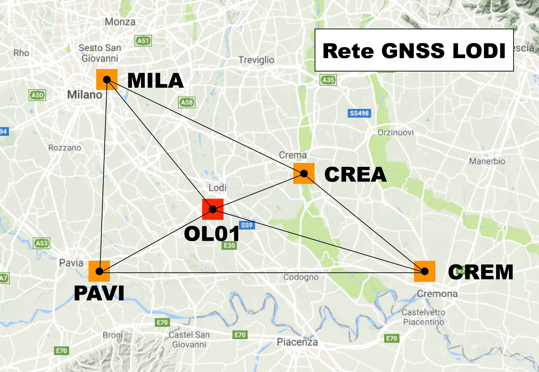
Figure 1 - La rete utilizzata per l'inquadramento della stazione GNSS OL01. Essa comprende le stazioni GNSS MILA (Milano), PAVI (Pavia), CREM (Cremona) e CREA (Crema).
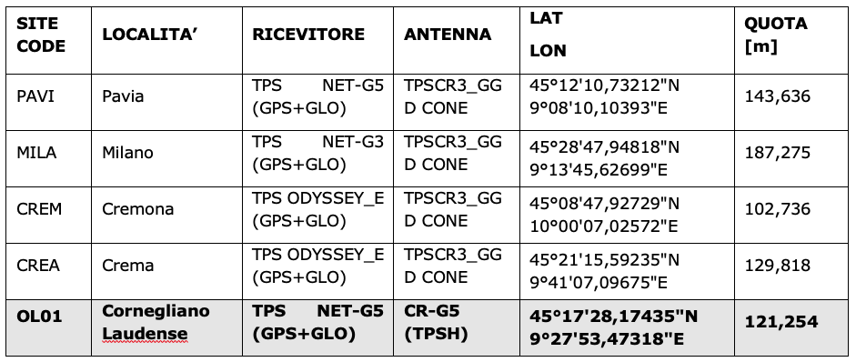
Table 1 - ETRF2000 (2008.0) coordinates of the PAVI, MILA, CREM and CREA stations used for the georeferencing of the OL01 site.